


Services
Sensing data-driven management
The Dutch government published the “Digital Connectivity Action Plan” in June 2018, which emphasizes the importance of a high-quality fixed and mobile digital communications infrastructure in the Netherlands to future-proof the Dutch economy.
With the Climate Signs solutions we contribute to the link between data from outdoor space and the operative translation to policy and management. Climate Signs uses existing objects from public space, which can be deployed as backbone infrastructure for mobile operators. A sustainable and innovative solution by making smart use of existing infrastructures and introducing new forms of cooperation.
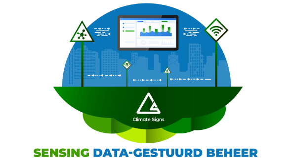
Data-driven management of public space is becoming an increasingly important component for asset managers. Data-driven management consists of 3 main components

Manage data

Dashboard unlocking

Sensor data

Manage data
In order to bring together the most relevant building blocks of a future-proof digital infrastructure, it is important to connect different streams of information. This connection forms the basis for the most important primary data and management processes. Climate Signs and ErGIS have been working intensively together for years to make data from collection and disclosure to analysis and implementation transparent. The sustainable city agenda is primarily composed of 2 pillars:
- Sustainability (CO2 emissions reduction)
- Digitization
Because the data must be available to all chain partners, it is important for interchangeability that a uniform information model is used. Climate Signs cooperates in this with ErGIS, which is a knowledge partner of CROW in the field of the development of the Information Model for Public Space Management (IMBOR). Within the IMBOR model, all definitions and designations of all types of objects in public space are synchronized and merged into one universal dataset. The object types from the Large-Scale Topography Registry (BGT) and the Geography Information Model (IMGeo) form the basis for this.
In a data-driven management organization, the data manager plays an advisory and support role.
All asset data is stored and accessed in an open source database and connected to other data sources and applications via a secure connector.
All existing data and maps are easily unlocked with GeoVisia Online to a well-secured Cloud environment.
From the online environment, the data can be accessed and consulted from any device (iOS, Android or Windows).
The available data can easily be shared from one central environment, allowing work processes to be organized centrally.
The data revolution is also taking place in the outdoor space and Climate Signs is the first in the Netherlands to have specific IoT solutions for traffic signs, which is linked to an online data dashboard.
With the push of a button, real-time insight into the “management health” of the area.
Dashboard unlocking
Data and sensors do not add value if they cannot be accessed in an integral way. For this reason, Climate Signs works with knowledge partners who have long been pioneers in the development of GIS/GEO systems. The in-house developed GeoVisia online traffic sign module enables us to unlock all management and sensor data together, in one user-friendly environment and map image online. Asset management of public space must be combined with sustainability, energy transition and climate adaptation. An up-to-date digital asset overview forms the basis of management. Regular visual inspections can reveal patterns in the damage picture, and reveal behavioral models. By combining the right algorithms with substantive knowledge, we can “predict” planned and regular maintenance. By programming the CO2 emission value of individual assets in the digital form, we can calculate CO2 emission scenarios of the area to be managed and visualize the effects. Data makes policy choices data-driven visible, so that asset choices can contribute to the social tasks of our living environment.
The VNG has also communicated that knowing and predicting will take a leading role.
Securing data-driven work is an organization-wide task.
Climate Signs has worked out a solid basis for a structured approach.
User-friendliness, safety, accessibility and reliability are paramount in our dashboard.
The Climate Signs dashboard is relevant to all chain partners and helps to gain real-time insight and act proactively.


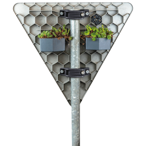
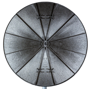
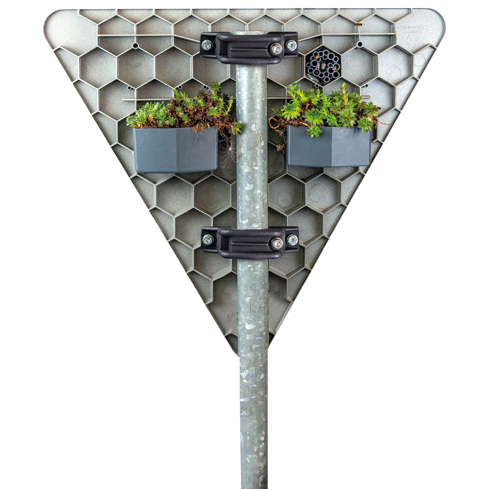
Sensor data
More and more people, machines and objects are connected to the Internet, generating data 24/7. Combining this data puts smart applications within reach. To collect operational data, it is crucial to connect the right sensors to Climate Signs traffic signs. The design, the unique honeycomb structure on the back of the Climate Signs traffic sign lends itself ideally to ‘plugging in’ a multifunctional sensor module. The addition of a sensor to the traffic sign fits within the Internet of Things (IoT) strategy, linking assets to the Internet so that they can be interactively exchanged. Municipalities and provinces gain real-time insight and steering information for daily management through this sensor data. If a sign is crooked, or there has been a change in rotation of the image plane, an operational repair action can be triggered. Each asset can be equipped with its own sensor, which is provided with a unique ID code (identification key). In time, Climate Signs traffic signs, or in combination with the linked charging station hubs, will allow us to measure real-time CO₂ emissions, nitrogen, air quality, temperature, humidity and many more relevant natural elements. Climate Signs aims to use this to map the “health” of the city. The Climate Signs sensors and data help cities work more efficiently, realize cost savings, and contribute to climate goals and road safety faster and in a more targeted way.
Advantages
Climate Signs’ management data, dashboard and sensors enable asset managers to see in real time how the city’s “health” is doing. Static data and specific computational rules help shape the sustainable development of outdoor spaces.
- We digitize outdoor space
- We enrich basic management information with high-quality utility & necessity data
- We support and advise managers in making sustainable choices
- We provide State of the Art sensors that can be read in the dashboard
- We use real-time data which is readily available through the Climate Signs GeoVisia Dashboard
- We use the dataset to calculate the CO2 emission value of the area
- We unburden our clients with our knowledge & expertise
- We contribute to the future-proofing of Dutch cities
- We connect administrators, policymakers and administrator in an approachable and effective way
Want to know more about Climate Signs?
Please feel free to contact us!
Visiting address
Bramenberg 22
3755 BZ Eemnes
Contact details
Tel: 035-3038430
E-mail: info@climatesigns.nl
"*" indicates required fields